Pointe Caron is the place where François D'Urfé, a missionary of the Order of St-Sulpice, had his chapel in 1686. One of the earliest maps that shows the exact location
is a map named "General description of the island of Montreal", drawn in 1702 by François Vachon de Belmont.
Belmont calls today's Pointe Caron "Pointe D'Urfé" and it is marked with the sign of the Saint Sulpice and a cross on top.
On the side it says "Eglise ou paroisse St Louis", Church or Parish of St Louis. On the left it says "1) Terre de l'Eglise 14 arpents" and "2) Lalonde 4 sur 20".
Pointe Caron is named after Antoine Caron, a farmer, whose family and descendants owned the land from 1832 to 1906.
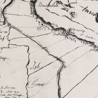
Map of Montreal drawn by Francois de Belmont in 1702, shows church at Pointe D'Urfé, source: http://collections.banq.qc.ca/ ark:/52327/2244788
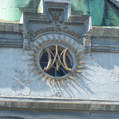
The Ave Maria sign of Saint Sulpice, an A and a M drawn on top of each other, photo: Montreal old port, 2019
The parrish of this area was created in summer of 1685 under the name of St Louis and in the same year, on Sep. 20, the
Bishop of Quebec, while on the visit to the area established its boundaries "from Pointe-Claire inclusive to the west by the
lands beyond the end of the island".
François D'Urfé records his first marriage November 29, 1686 and his last entry is from October 18 , 1687.
The war with the Iroquois forces him and the settlers to retreat. The area is only re-occupied after 1698 while the peace with Iroquois was signed in Montreal in 1701: "La Grande Paix de Montréal" (see https://en.wikipedia.org/wiki/Great_Peace_of_Montreal, Great Peace of Montreal, signed August 4, 1701).
François D'Urfé returns to France and René-Charles de Breslay, who establishes later in 1714 the church in St Anne, continues the work as priest at the parish of "St Louis du haut de l'Isle". There is no entry in any register from 1688 until 1703.
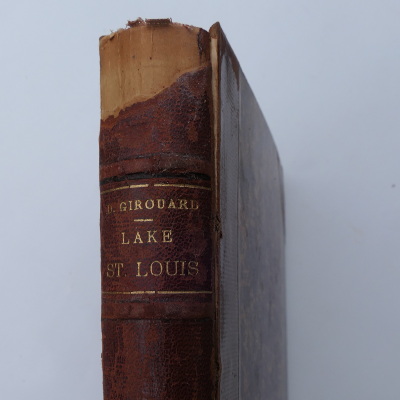
Désiré Girouard (1836-1911), a former supreme court judge, has in his book "Lake St. Louis, old and new, illustrated, and Cavelier de La Salle" an entire chapter about "The Chapel of St Louis". The book was published in 1893 and the copyright has expired. I can therefore replicate the relevant pages. Click below to read them.
Desire Girouard did a very detailed analysis of church registers, land registers and other documents. It's one of the most detailed texts about the chapel at Pointe Caron.
François D'Urfé provides some clues about the chapel and the graveyard at Pointe Caron. He writes in his register "the place intended for the church of St Louis" and on another pages he writes "inside the church". With regards to the cemetery he writes "buried in the cemetery of the parish of St. Louis" and then again "buried near the place destined for the cemetery". This seems like a contradiction but there is a very simple explanation. Only a small chapel with a burial ground was built, while the idea was to build a much bigger church and François D'Urfé had already ideas for the exact location of this future church.
The chapel at Pointe Caron is no longer standing and a full church was never built. The cairn with the plaque in front of the Red Barn is the most visible item about the history of "Pointe D'Urfé". There are also some old stone walls at Pointe Caron itself that might date back to the times of François D'Urfé.
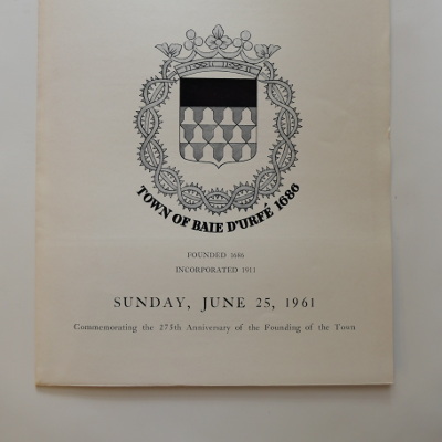
The cairn is built with stones from the Château d’Urfé (Château Cornes d’Urfé) in France and the inside is filled with stones from Pointe Caron. It was built in 1961 and the official unveiling was on June 25th, 1961 in the presence of guests from France.
The original plaque was made from solid copper. It disappeared in 2012 and has now been replaced by a plastic plaque. A small translation error slipped into the text when it was translated from English to French. It should have said in French "Près d'ici" instead of just "Ici".
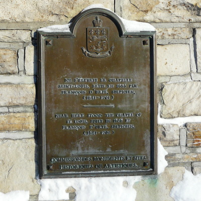
Original plaque from 1961, photo Feb. 2011
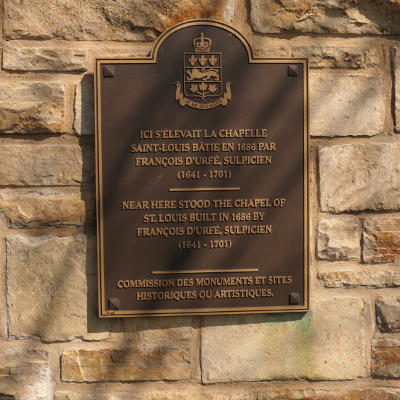
Current plaque, photo May 2020
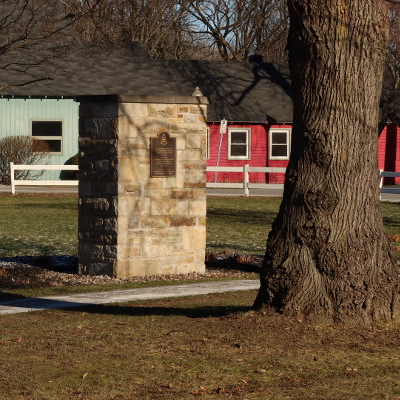
The cairn, photo: Dec. 2020
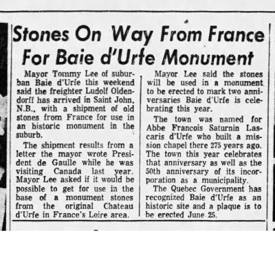
Stones from France, The Gazette, Jan 16, 1961
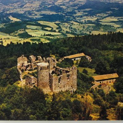
"Château Cornes d’Urfé", Champoly-sur-Loire, France, aerial view, about 1960, built 1408 by Guichard d’Urfé, stands at 927m, excellent view over entire region, outer stones of cairn are from this castle
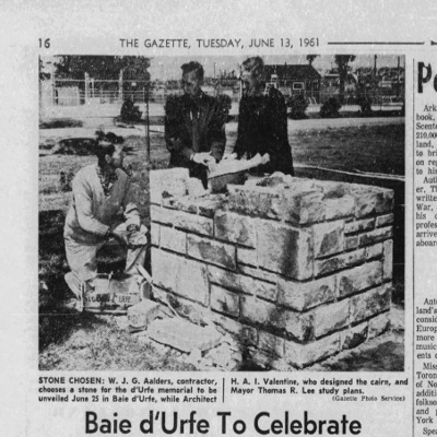
Building the Cairn, The Gazette, June 13, 1961
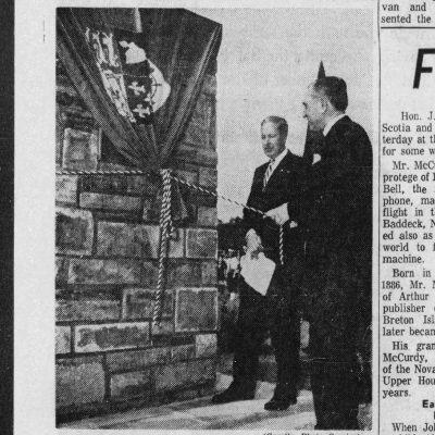
Unveiling of the Cairn, The Gazette, June 26, 1961
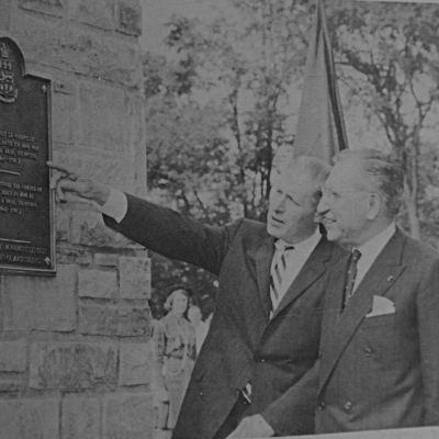
Mayor T. Lee showing the cairn to François Collavéri Prefect de Loire (France), Baie-D’Urfé June 25th 1961, source: N&V
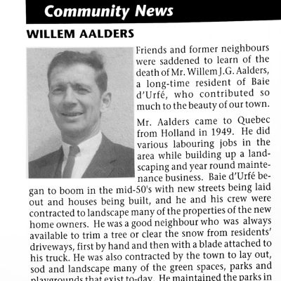
Willem Aalders (21-Jan-1918 to 23-Feb-2001), this is the person identified as "contractor" in the Gazette article from June 13, he lived at #66 Morgan, source: N&V April 2001, click photo to read
Excavation of graves and archeological research projects
In the autumn of 1859 graves were found during the excavation of a basement for a house at Pointe Caron. The "Echo du Cabinet de Lecture Paroissial" (see pdf page 12/13, orig. p.80/81, text in French), published in March 1866, has references to what was found besides the bones of the bodies. "On one of the skeletons we found a pretty crucifix in
copper mounted in ebony....On a second one another crucifix was found, less precious than the first. On another, we found a tin dish, black pearls the size of our French cherries, a small crucifix and a beautiful copper medal perfectly preserved. One of the faces bears the image of the holy virgin with the inscription: "Sancta Maria, ora pro nobis". The other bears the figure of a Franciscan, with crucifix, book and rosary, and surrounded by the inscription: "S. G. Dei Interc.i.pro nobis." In two graves we found pearls smaller than those just mentioned, and with the bones of a child several discs of white porcelain the size of our money, and pierced with two holes through the face. In one grave we found the bone of a finger carrying a copper ring, and in another a tomahawk that the rust has hardly damaged and which could still last an Indian for life."
All the skeletons and bones where transferred to the church in St Anne and buried together in a single vault. A plaque at the church in St-Anne, added later by the Lalonde family, explains this. The plaque was originally located on the outside but to protect it better it has been moved a few years ago to the inside of the church.
The plaque mentions the names of those that were transferred to St-Anne. How do we know the exact names? These are documented in the D'Urfé register but there may be bones of other people that had been tranfered too.
En mémoire de
...liste des noms avec l'âge...
Huit de ces dix Française inhumés dans le cimetière de
la paroisse Saint-Loius du Bout de l'Îlse (Baie D'Urfé) en
1687 furent tués lors d'escarmouches avec les Iroquois.
En 1866, leur dépouilles furent exhumées et inhumées
à nouveau dans la crypte de l'église par Georges Chèvrefils,
curé de la paroisse Saint-Anne-de-Bellevue.
Association famille Lalonde d'Amérique
Septembre 1987
Translation:
In memory of
...list of names with age...
Eight of these ten Frenchmen buried in the cemetery of
the parish Saint-Louis du Bout de l'Îlse (Baie D'Urfé) in
1687 were killed in an attack by the Iroquois.
In 1866, their remains were exhumed and buried
again in the crypt of the church by Georges Chèvrefils,
parish priest of Saint-Anne-de-Bellevue.
The association of the Lalonde family of America
September 1987
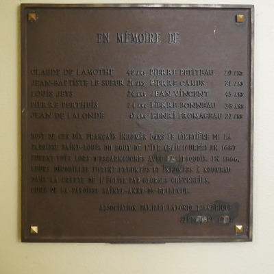
Plaque at the church of St-Anne-de-Bellevue, photo: Jan. 2020
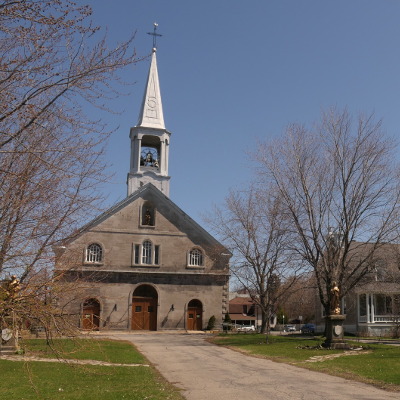
The Catholic Church in St-Anne-de-Bellevue, photo: May 2020
The obvious question still remains: Where exactly on Pointe Caron was the church/chapel and where was that cemetery? No maps or drawings were produced during the excavations in 1859/1866. A description of the excavations mentions that the bodies were found between two parallel walls, 26 feet (=8m) apart, going from north to south in the western part of Point-Caron. No walls perpendicular to those parallel walls were found.
The earliest precise aerial pictures of Pointe Caron are from 1930 and it is very likely that the house would still be standing in 1930 or at least parts of it. In 1930 fields can be seen on Pointe Caron near Lakeshore road and the only houses are near the tip and slightly to the west.
This means that the main cemetery would have been in this area, near the tip of Pointe Caron on the western half.
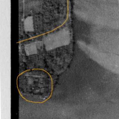
Pointe Caron, May 1930, Lakeshore Rd. and area with houses marked, photo: The National Air Photo Library
Pointe Caron has soil with high rock content in the southern part (towards the tip). This makes it hard to plow and therefore farming happened only further inland, in the northern part.
In 1988 archeologist Françoise Duguay came to Pointe Caron and found the base of a chimney, foundation walls and stones arranged in groups. It is possible that these structures go back to the times of François D'Urfé. It is also possible that a farmer had built a small house or some storage building and over several generations the knowledge about those buildings had been lost. Nobody knows for sure. A second archeological research was financed by Montreal around 2004 but it ended abruptly once Baie-D'Urfe took over after the successful demerger.
The chimney and walls were found towards the east. It was not possible to show that these structures were part of François D'Urfé's mission however no record of a house in this location existed.
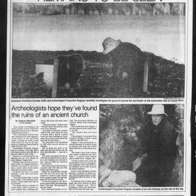
Archeologist at Pointe Caron, The Gazette, Oct 19, 1989, click image to read, note: Douglas D. Foss (1927-2013) and Lynn Foss (nee Watson) lived at Pointe Caron #6, family sold house in 2015
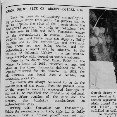
N&V report about the archeological dig at caron point by Christine Goodey who had participated in the project, she lived at 37 Morgan and she is one of the authors of the Baie d'Urfé 1686-1986 book, source: N&V Oct. 1989, click on the picture to read
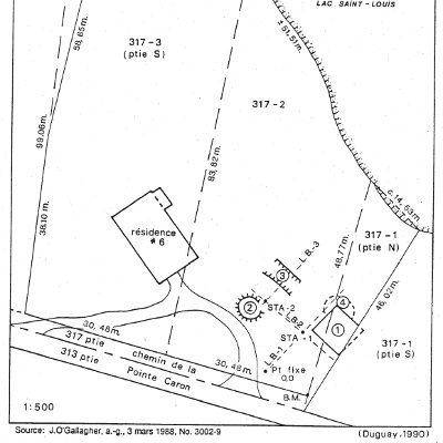
Map of the 1988/1989 archeological research, click image to view it in full size
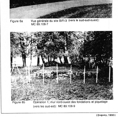
Stone foundation wall in 1988/1989
Stone foundation wall in May 2020
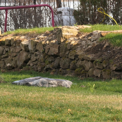
Stone foundation wall in May 2020, eastern part of Pointe Caron
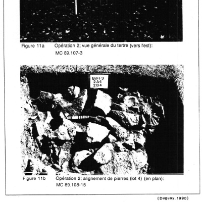
General view and group of stones, Duguay archeological investigation, 1990:
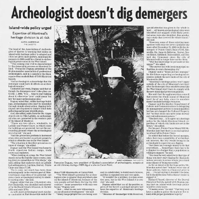
Archeologistis at Pointe Caron have to stop, The Gazette, March 3, 2005, click image to read, note: the Gazette seems to have re-used the 1989 picture of the chimney
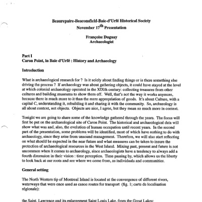
Transscript of a presentation given by Françoise Duguay, Nov. 17, 2004 to the Beaurepaire-Beaconsfield-Baie-d'Urfe Historical Society
We don't know exactly what those structures on the eastern side of Pointe Caron are. A section of this ancient stone foundation is visible today above ground and serves now as ramp for a driveway. All other structures would be below ground.
Pointe Caron is no longer a real "Pointe" because the yacht club sticks out much further but a photo from 1955 shows very clearly how it used to be and it would have been like this during the times of François D'Urfé.
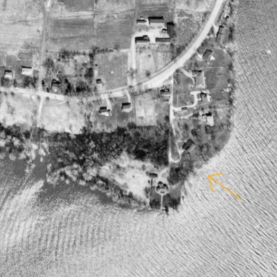
Aerial image of Pointe Caron from April 1955, "dent" marked with arrow, photo: The National Air Photo Library - Natural Resources Canada
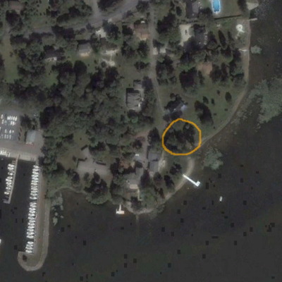
Aerial image of Pointe Caron from Aug. 2005, site of 1988-1989 archeological investigation marked, no 1989 image available but there would have been minimal to no change until 2005, photo: google earth
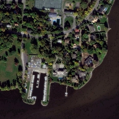
Aerial image of Pointe Caron from Oct. 2017, photo: google earth
If you look carefully at this aerial picture then you see that Pointe Caron has a dent towards the east (marked with an arrow in the 1955 photo). Water from the Ottawa river runs from the west past Pointe Caron and the current is not strong but without the yacht club it would have still caused canoes and other small boats to drift away easily. A much safer and more convenient spot to go on land would be this small dent towards the west. No roads existed in 1686 and many people would have arrived by boat.
This little dent presents a perfect landing spot for small boats.
This is were people would have arrived and it makes sense that the chapel would have been near this area. The old stone foundation wall is just a few meters away from this landing spot.
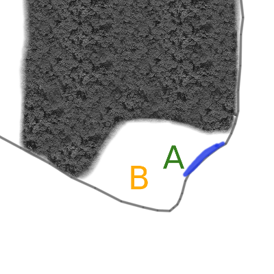
Likely scenario, Pointe Caron in 1686, blue: landing/arrival area for boats, A: area with chapel and house, B: graveyard area
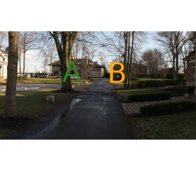
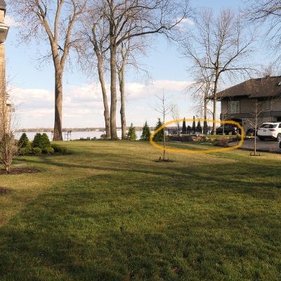
Street level view of Pointe Caron, photo: May 2020
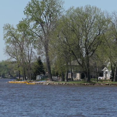
Pointe Caron view from north-east, arrival area for boats marked in orange, photo: May 2020
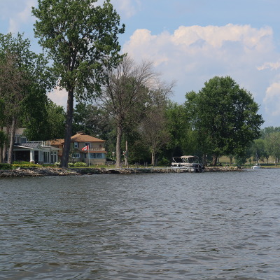
Pointe Caron "dent", arrival area for boats, view from the water (from south-east), photo July 2020, boats would have moored where you see the dock and the motorboat
A nice view towards Dowker Island and Montreal, morning sun and a perfect landing area for boats in front. The graveyard in the back. We have no hard poof that it was really like this but we have some corroborating evidence. This is a probable scenario.
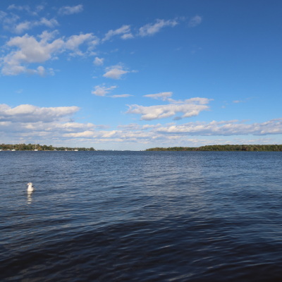
View from Pointe Caron towards Dowker Island and Montreal, photo Sep. 2020, click on the picture for a high resolution photo
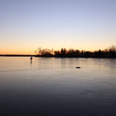
View from the bay towards Pointe Caron, winter sunset, Dec. 29, 2020, perfect ice for skating
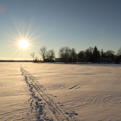
View from the bay towards Pointe Caron, photo: Jan. 2021
I would like to thank Pauline Faguy-Girard and Walter Hrycyna of the Société historique Beaurepaire-Beaconsfield for their contribution of information and very valuable documents to this project. I would not have been able to do this without them.
The Jean de Lalonde Monument
Jean de Lalonde was the first settler in this area and he became the first church warden at the Chapel of Saint-Louis.
François D'Urfé buried all others either "in the cemetery" or "near the church" or "near the place to build the church". Jean de Lalonde is the only one who was buried inside the church (dans l'enceinte de l'Église). The Lalonde family erected 300 years after Jean's death a memorial. It stands near Point Caron, at Berthold Park.
The monument was designed by Nelu Wolfensohn, now professor for design at l'Université du Québec à Montréal (UQAM). The Lalone family has a description of it on their own web site: https://web.uvic.ca/~lalonde/history/monument.html (local pdf copy, archived June 2020, 396K Bytes).
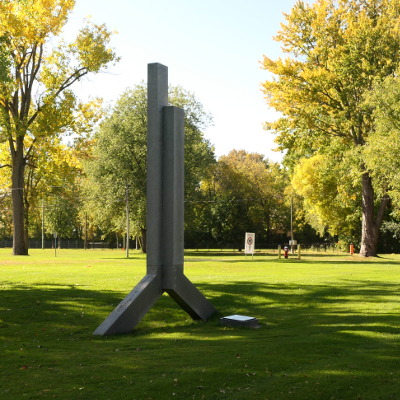
Jean de Lalonde monument, photo Oct. 2019, it has the form a "J" and an "L" back to back
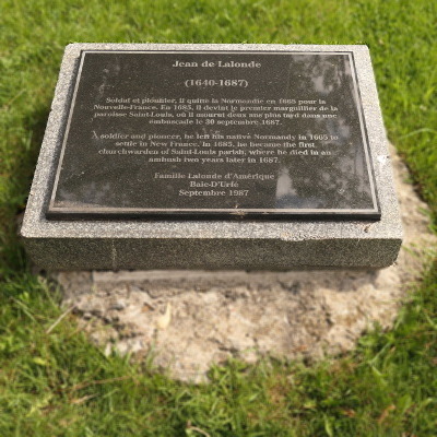
Jean de Lalonde monument
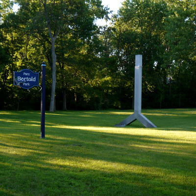
Jean de Lalonde monument, photo July 2019
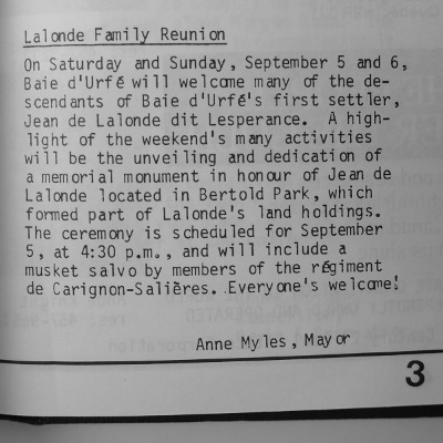
LaLonde family reunion, source: N&V Sep. 1987
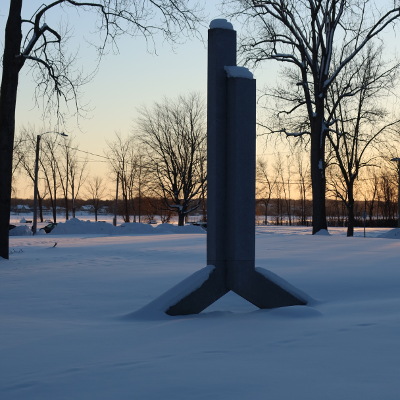
Jean de Lalonde monument, photo: Jan. 2021
Further north a street is named in honor of Jean de Lalonde and it is on land that was once given to him.
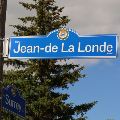
Jean de Lalonde Road, photo June 2020
The lighthouse at Pointe Caron
Pointe Caron was "sticking out quite far" prior to the creation of the Yacht Club and presented an excellent position for the installation of a navigation light. The next navigation light in the Baie-D'Urfé area was on Dowker Island. These navigation lights are obviously a more recent invention compared to the history of Pointe Caron itself. Pointe Caron had a lighthouse with a wooden tower installed in 1874 and later, in 1934, it was replaced by a simple red light on a steel skeleton tower. The steel tower was a bit higher than the original wooden lighthouse. The light and tower were finally removed in 1996. Below are a picture of the original lighthouse and the subsequent navigation light on the metal tower.
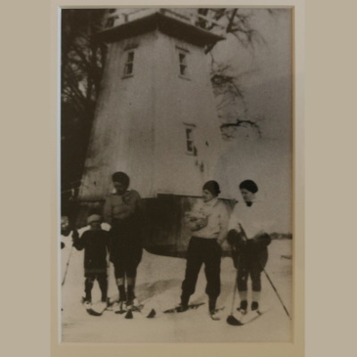
Pointe Caron lighthouse in the 1920s
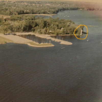
Pointe Caron and Yacht Club in 1966, navigation light marked in orange
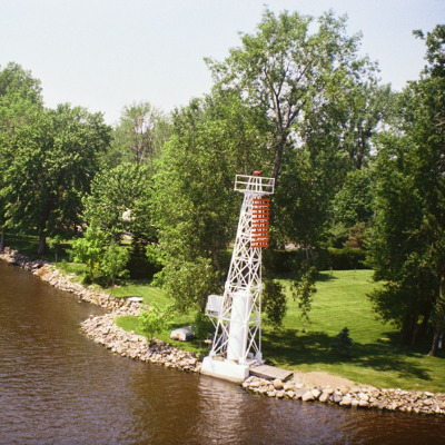
Pointe Caron navigation light summer 1981, source: http://numerique.banq.qc.ca/ patrimoine/details/52327/3155721
This page contains some material copyrighted by third parties but all other content is
free and available under the creative commons Attribution License (CC BY 4.0).
Guido Socher,
->back to "A HISTORY OF THE TOWN OF BAIE-D'URFE, 1977 edition"
or
-> go the index


