Angell Woods is a large forest area in Beaconsfield. It's a great place to go for walks and there is no
entrance fee. Local community groups have fought for years to preserve this forest. Today a large
portion of it is public or belongs to an organization that wants to preserve this forest. Only small portions of this nice hardwood forest are still owned by companies who would prefer to cut it down for a good profit.
The trails in Angell Woods are not officially marked or maintained. There are a few paths that are used
by many people and I recommend to start on those main paths before you explore smaller paths. You could
potentially get lost in this forest. Here is an accurate map of the most used trails to help you explore this
forest area:
- north is at the top of the map
- blue area: this area floods after heavy rains
- the main trail: this the path going east-west. It's the orange path and the part of the green path going east west.
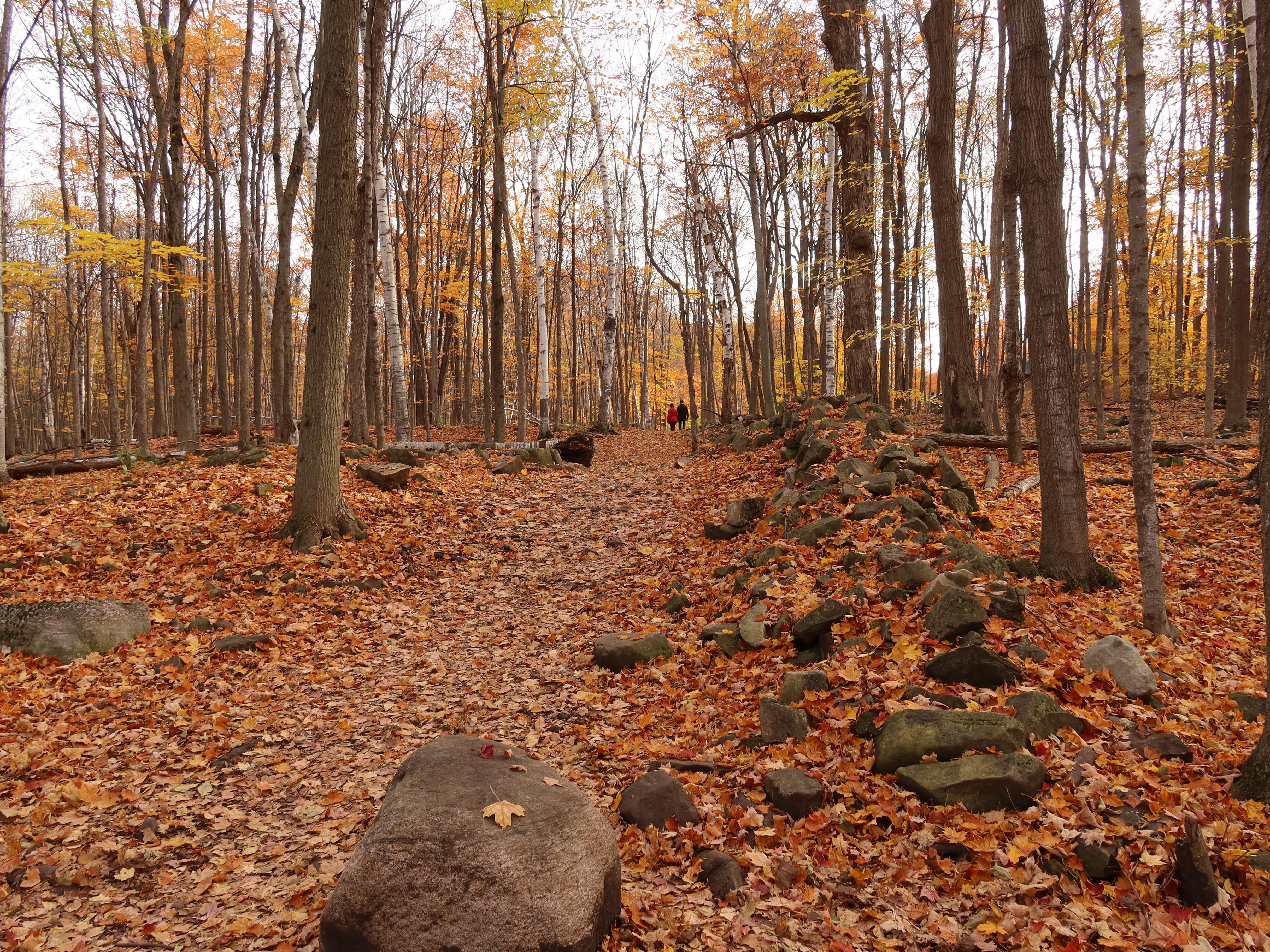
point 1) main path meets a field stone wall
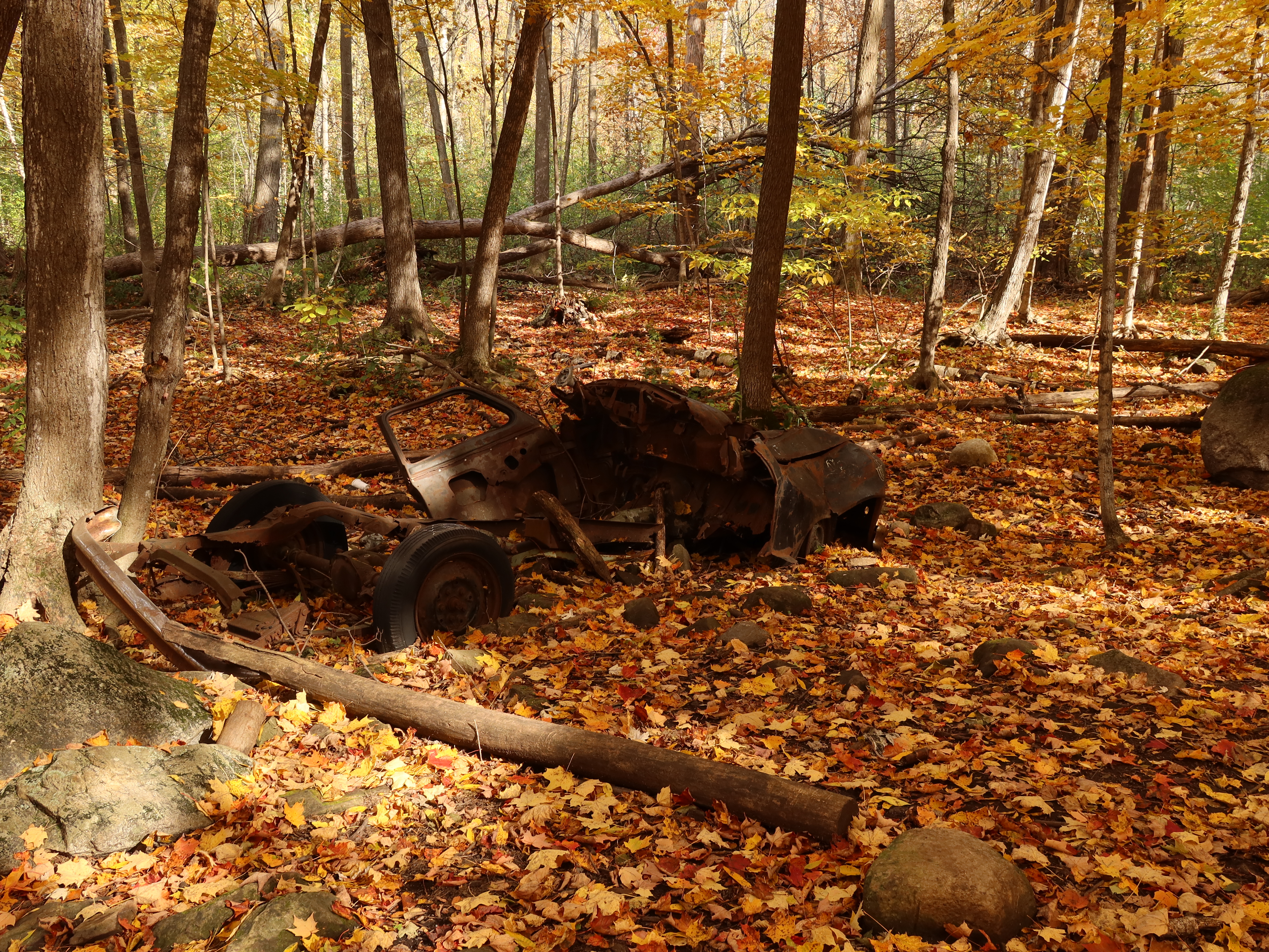
point 2) black car wreck
The black trail starts at the end of Lakeview Street:
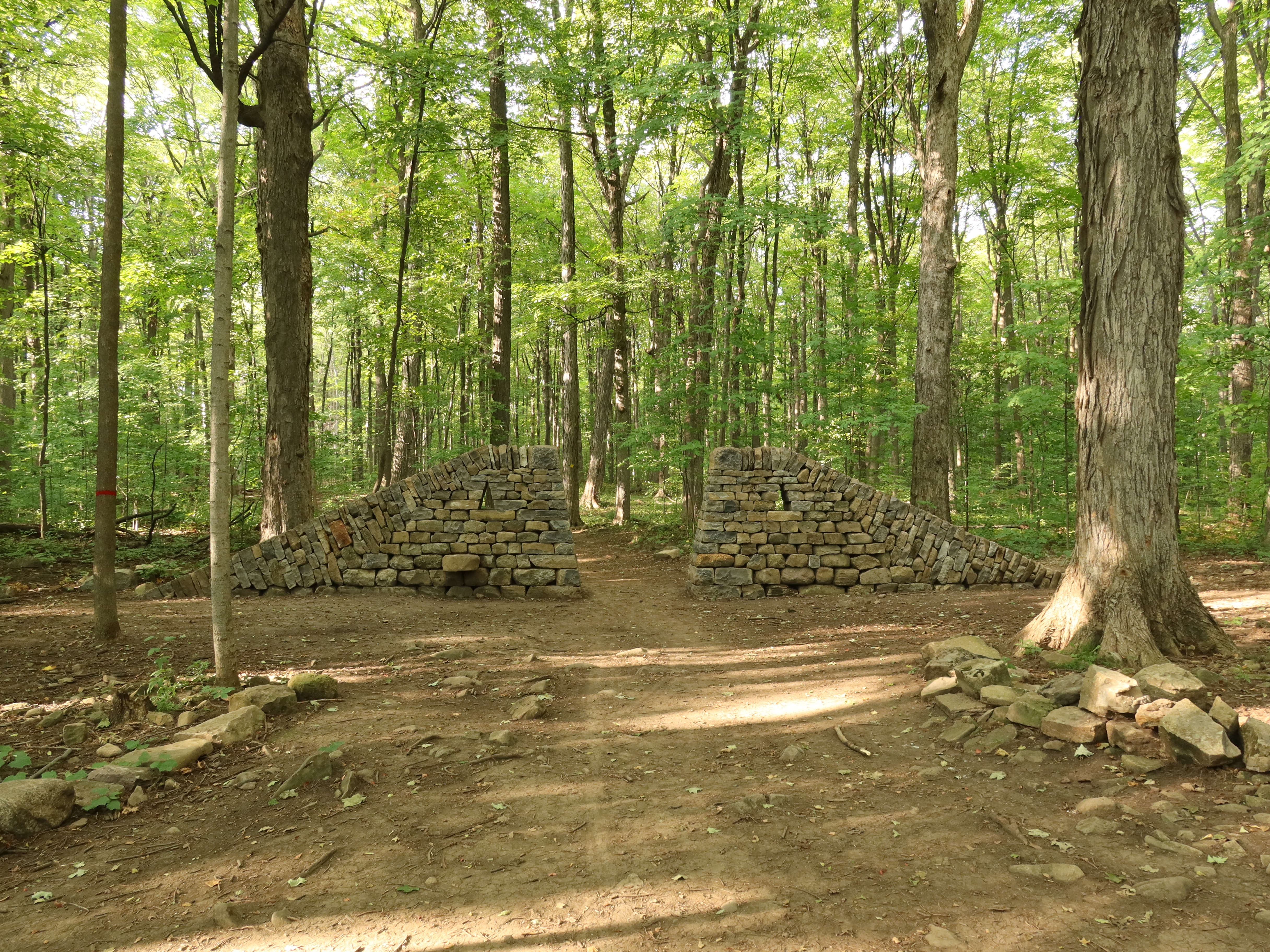
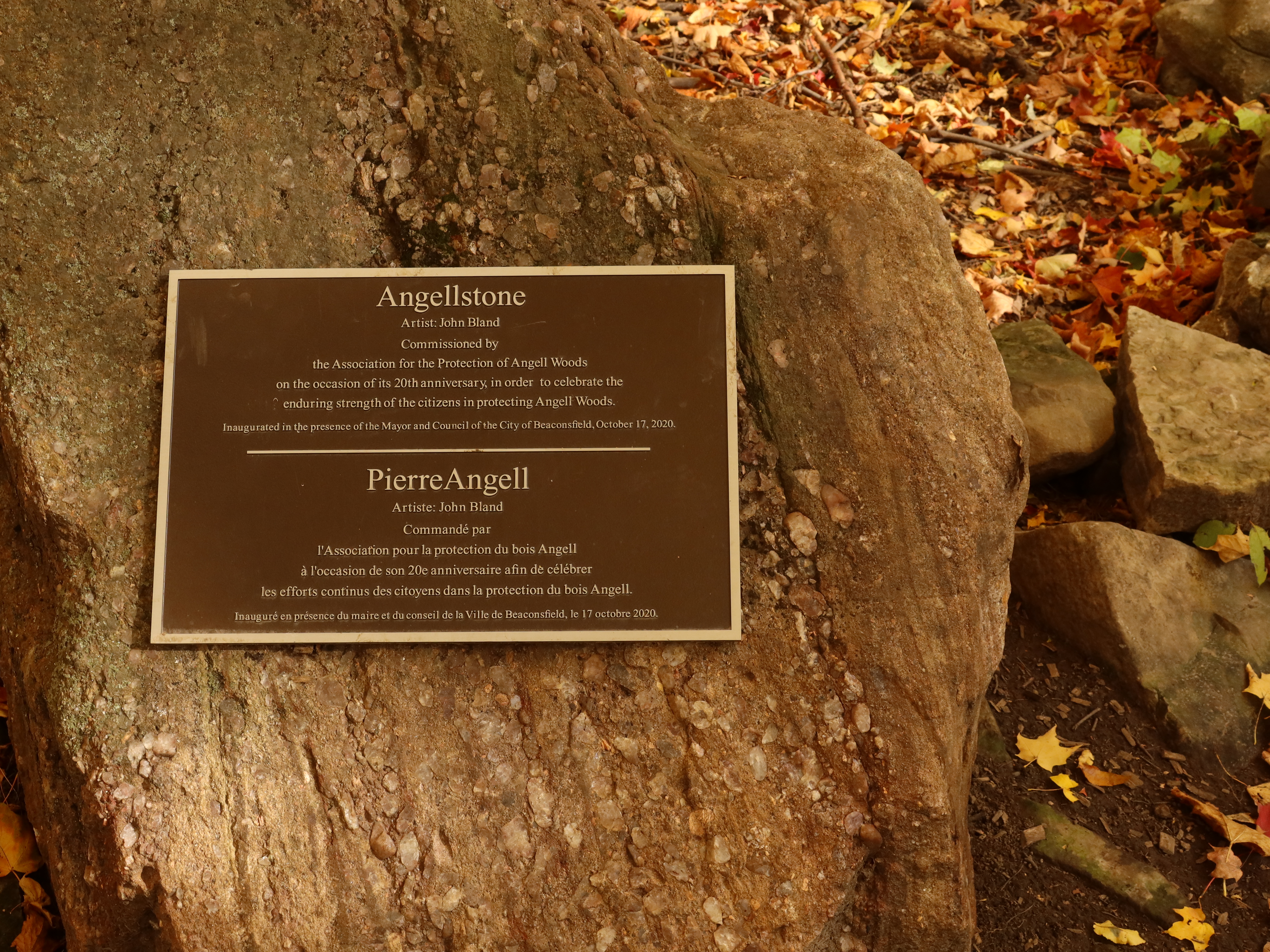
point 3) Angellstone wall. Angell Woods Monument by artist John Bland
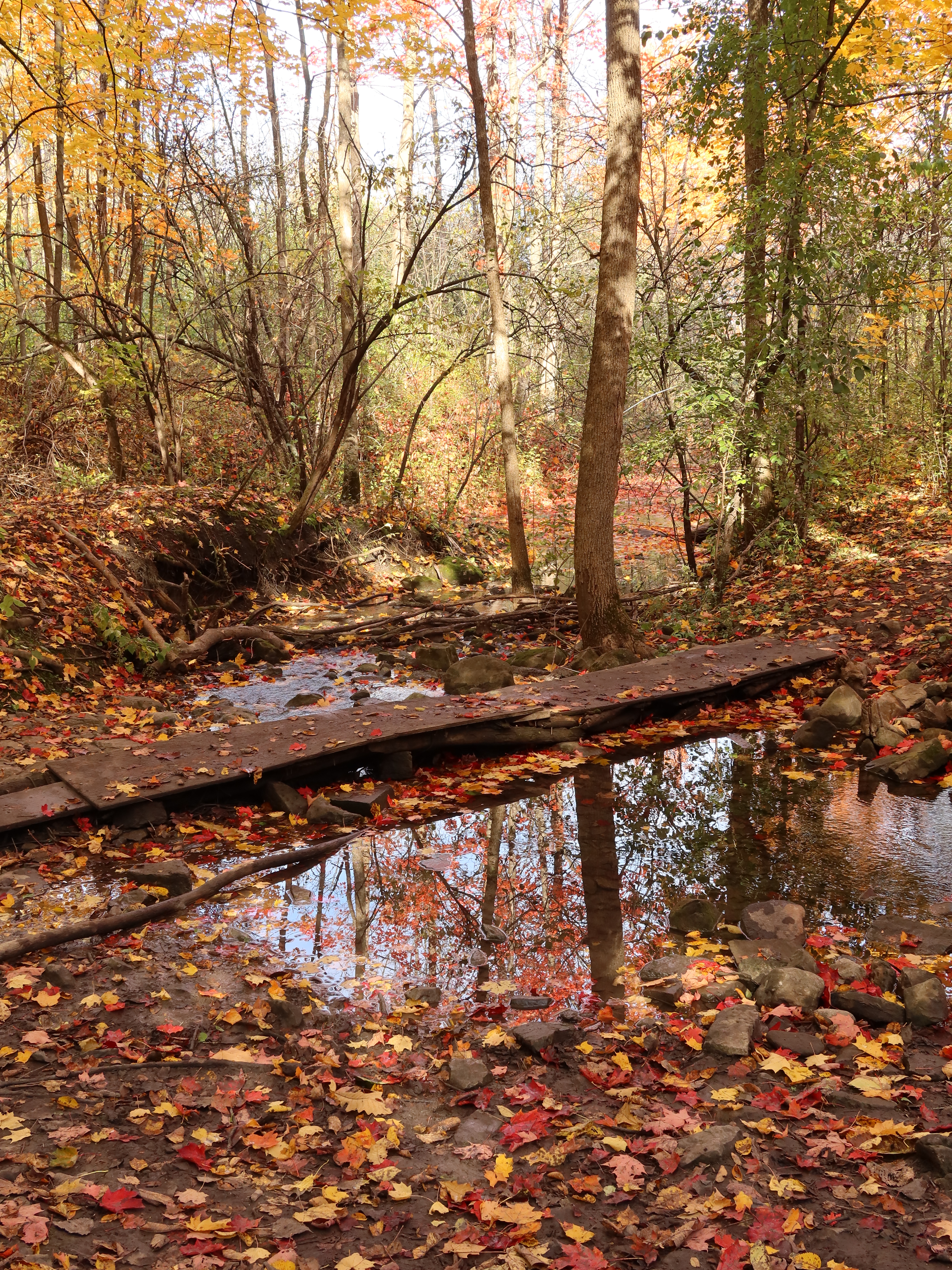
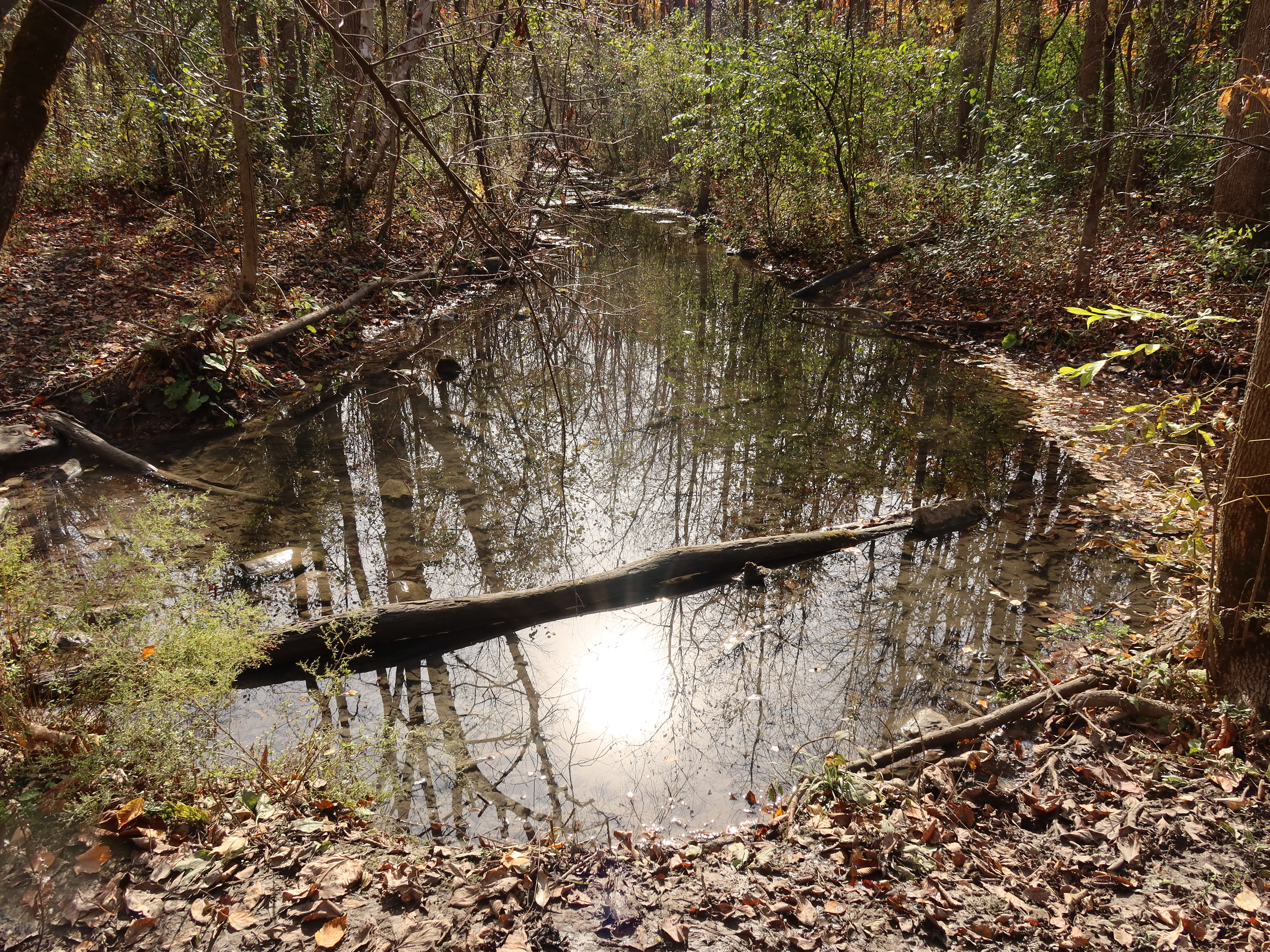
point 4) Ray's point. Two streams intersect and there is a small bridge made of tree trunks and some plywood.
point 5) the yellow path ends here after a rainfall because a large pond forms and it is about 1 foot deep
point 6) playground: Stephen-Walsh park. The black trail starts at the back of the playground but this area is still owned by somebody who does not want others to walk there.
point 7) a well maintained path starts at the end of the dog-park parking lot and runs straight to James Shaw Street (the point where the orange trail starts)
- Start of the stream near the intersection of the red path and the green path:
How to explore Angell Woods
The best points to start are either:
The parking lot of the Beaconsfield Dog Park, "7)" in the map
James Shaw Street in Beaconsfield North. This is the start of the orange trail in the east.
Stephen-Walsh park: park your car near "6)" and then walk westwards into Stephen-Walsh road onto the green trail.
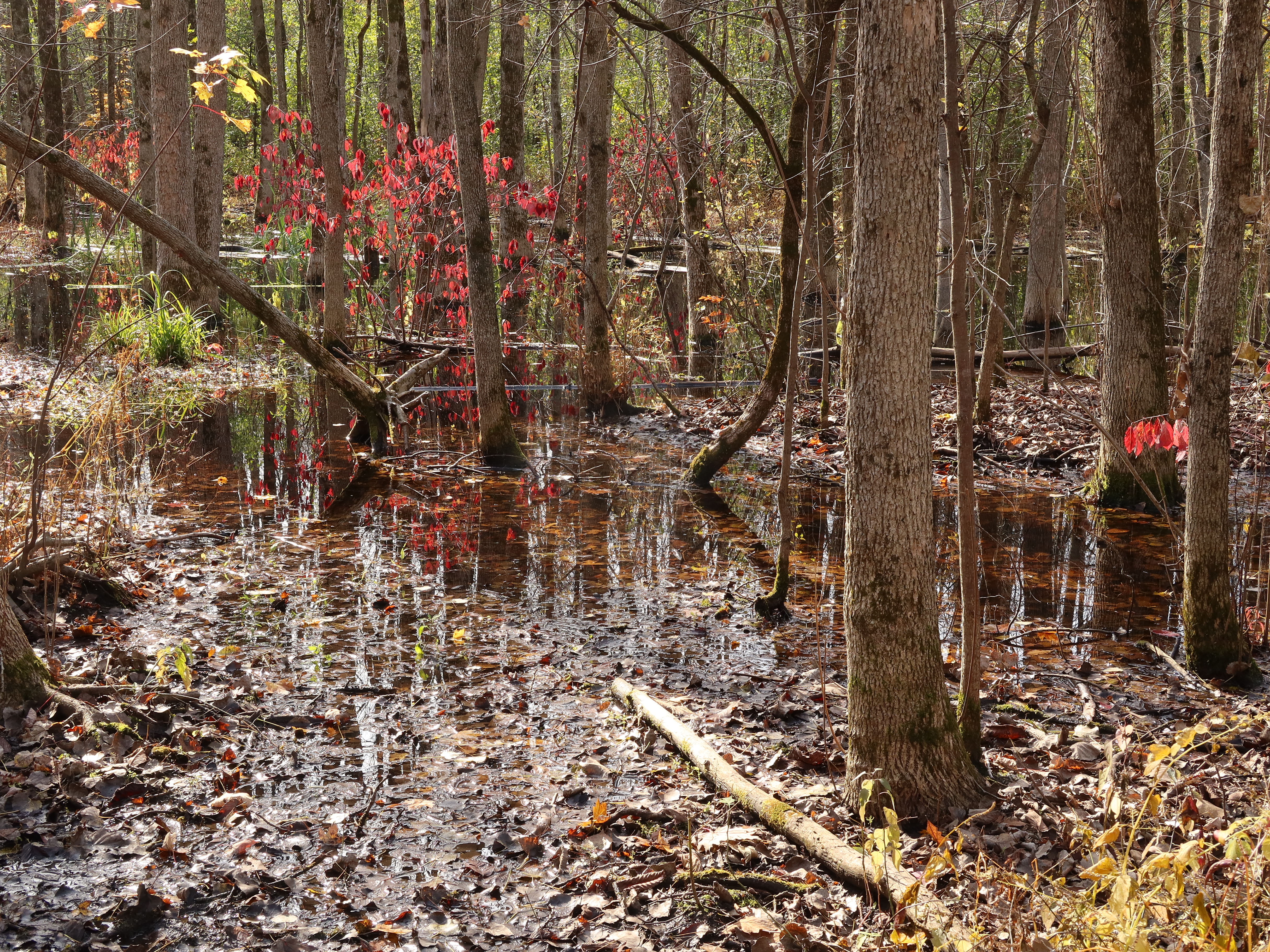
A small stream runs through Angell Woods and I don't really recommend to go hiking unprotected between May and July because you will encounter a lot of mosquitoes.
Angell Woods history
Much of the Angell Woods area used to be farmland belonging to the Valois and Angell families and
you can still see the fieldstone walls that they built by removing rocks while trying to plough
these fields.
It must have been hard work to plant something on those fields. Despite all the fieldstone walls there
are still plenty of boulders left on the ground.